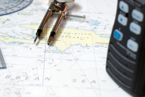
Sure, there are boaters that don’t use them. You may even be one of those boaters. However, any time you venture beyond familiar waters you’d be wise to have a nautical chart – and know how to read it. We’re here to tell you that they’re not as daunting as they look. Once you get acquainted with nautical charts, which can take as little as 10 minutes of study, the mystery shrouding them dissipates like fog on a sunny morning.
A nautical chart is far more sophisticated than its land-focused cousin the familiar road map. Yes, it’s a map of the water, but it communicates what you can see and what you can’t. It specifically depicts “water areas of importance” like land contours, water depths, and more. Need to know where to find red buoys and green buoys? You sure do, and your handy nautical chart has you covered. So, let’s take a look at the how and why of the nautical chart.
Where do you get a nautical chart?
You can access free nautical charts from the National Oceanic and Atmospheric Administration (NOAA) online. There you’ll find NOAA’s new web map viewing application that shows chart data previously only available to users who purchased specialized viewing systems. For a hard copy that you can hold in your hands (still the most popular), and covers your local area, visit your neighboring marine supply store or your marina’s ship store. One tip; don’t refer to a nautical chart as a map, that’s like calling the bow of your boat the pointy end.
How to read a nautical chart scale
 When choosing a nautical chart for specific waters, you can choose between two scales; one that covers a smaller area in greater detail or one that covers a larger area in less detail. You’ll see the scale represented as a fraction. For example, if the scale is 1:30,000 it means that 1 inch on your chart equals 30,000 inches in real life. In simpler terms, 1 inch is about 0.4 nautical miles. Therefore, one nautical mile will be around 2.5 inches. Always check the units on your chart. The reason is that a chart from Canada won’t use inches, and the scale will be different. Here’s the rule of thumb:
– Small-scale charts provide greater detail but cover a smaller area. Harbor charts (very detailed) may have a scale around 1:20,000.
– Large-scale charts provide less detail but cover a larger area. A large-scale chart could be just a general chart or a coastal chart. The scale may be 1:80,000 or even 1:1,000,000.
What are depths?
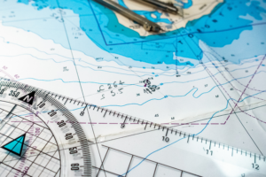
You can probably guess this one. Depths are numbers printed on the water areas of the chart that indicate the depth of the water at that spot. The key is to know the unit of measure being used. For instance, a 2 on the chart might mean two feet, two fathoms, or two meters. The unit of measure is always shown on the face of the chart in large print, like this “SOUNDINGS IN FATHOMS AND FEET”. There is, however, a code you need to understand. For example, a fathom is six feet, so on a chart with soundings in fathoms, the number 03 means zero fathoms and three feet. The water at this spot is three feet deep at mean lower low water (MLLW). A sounding of 55 means 35 feet – five fathoms and five feet.
What are contour lines?
 Contour lines are the irregular, amoeba-like shapes in the water on the nautical chart. They’ll sometimes shade from lighter blue to darker blue. They depict the underwater landscape of mountains and valleys. Usually, the lines are represented in fathoms (six feet). This means a contour line depicts a change in depth of six feet. But not every chart is measured in fathoms and feet, so always check the scale on your chart to be sure. For instance, if you’re using a larger scale chart, contour lines will only be included for greater changes in depths. In deeper water, there may be as much as three fathoms difference between contour lines.
What are symbols and abbreviations?
Nautical charts also show the location of anything and everything you’ll encounter on the water. You’ll see symbols and abbreviations covering the gamut from rocks, reefs, wrecks, and other submerged obstructions, to anchorages, channels, lighthouses, buoys, and even tide rips.
The symbols and abbreviations are usually obvious, but some are not. Luckily you can find them illustrated and explained in a booklet titled Chart No. 1: Symbols, Abbreviations, and Terms. You can purchase it online or download it for free from NOAA here.
What is a compass rose?
At various locations on the chart, you’ll find a compass rose, which looks like a standard compass. The difference with a compass rose is that there are three concentric circles set inside each other. Each compass circle shows a different but important aspect of navigation. The outer circle shows true cardinal north. The inner circles show magnetic north. To understand the difference, we need to go back to high school geography. Basically, true north points you to the north pole. Magnetic north aligns you with the earth’s magnetic field. True north doesn’t move but magnetic north does. Since most boats steer by a magnetic compass, you’ll almost always use the inner circles – usually marked in degrees from 0 to 360.
Your next step toward nautical chart reading
We’ve just given you a bird’s-eye view of nautical charts. It’s not as daunting as you imagined. Right? For a more comprehensive explanation, we recommend How to Read a Nautical Chart, 2nd Edition: A Complete Guide to Using and Understanding Electronic and Paper Charts. It explains every aspect of paper and electronic nautical charts with practical and hands-on information. Before long you’ll have mastered safe and effortless on-water navigation to any destination.


